




About CelestialCartographer
From Steam WorkshopCelestial Cartographer Space is big. Your HUD should help you learn it. Celestial Cartographer turns planetary travel into an exploration and surveying loop. Approach an unfamiliar world, discover…
Celestial Cartographer
Space is big. Your HUD should help you learn it.
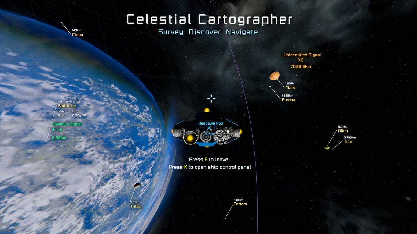
Celestial Cartographer turns planetary travel into an exploration and surveying loop. Approach an unfamiliar world, discover its gravity and atmosphere, observe environmental conditions, identify wildlife and vegetation, survey mineral deposits, and leave expedition notes. Knowledge persists between expeditions.
0.7.2 — performance and discovery update
This update reduces repeated HUD work: expensive card placement is normally refreshed about every 250 ms, stable text and measurements are cached, and projection/leader lines keep updating. Across the recorded approach and travel tests, approximately 93% of visible-card updates reused placement. This measures avoided placement searches, not an FPS multiplier. Please try this version if earlier builds caused slowdowns, sluggish cockpit controls, or jumping cards.
Shells now appear only while you control a cockpit/control seat marked Main cockpit, and only around the current/nearest planet. At most two discovered, enabled boundaries render: the nearest inward and nearest outward shell. With all boundaries discovered and enabled, you see gravity alone outside the well, gravity and atmosphere between those boundaries, and atmosphere and water between those boundaries. Remote control and other seats still support cards and surveying. If no cockpit is marked Main cockpit, shells remain off.
Mean sea level must be discovered through water contact before its shell or intercept marker appears. Water knowledge is saved, and a planet or water-section reset clears it. Older notebooks contain no stored water-contact evidence, so mean sea level must be rediscovered. The final local test confirmed discovery, the intercept marker, and shell visibility after leaving the water. Geology/biology sampling rates remain unchanged. Occasional timing spikes and slight card judder during very fast travel remain possible; further feedback is welcome.
See the shape of a world
Discovered gravity, atmospheric, and optional water boundaries provide planet-fixed latitude/longitude grids, close-range refinement, and flight-path crossing markers. Shell visibility follows the main-cockpit and two-boundary rules above. Floating information cards stay associated with the bodies they describe, expand with nearby environmental information, and avoid other cards and important HUD regions.
Build a survey record by exploring
- Gravity presence, boundary, current readings, and observed maximum
- Atmosphere presence, boundary, density, oxygen, and breathability
- Radiation and weather observations
- Geological and mineral discoveries
- Flora, forageables, fauna, and biome observations
- Water and aerodynamic/environmental telemetry when supported
- Persistent expedition notes and exploration objectives
Survey geology with real detectors
Automatic mineral discovery respects the sensors available to your character or ship. An equipped hand drill provides short-range detection. Grid ore detectors use their configured effective range, including definition changes made by overhaul mods.
Survey planetary deposits, voxel boulders, meteor remnants, asteroids, and manually extracted resources such as Stone, Ice, and Organics. Planetary mineral maps accelerate searches; live voxel material must confirm a deposit before it is recorded. Standalone asteroid discoveries are retained under the Interplanetary Space record.
Biology and environment
Nearby fauna and qualifying forageables are recorded through observation, proximity, and line-of-sight checks. Standing flora and biomes are sampled incrementally. Manual entries remain available for unusual or heavily modded environments. Optional integrations are detected automatically and are not required for core surveying.
Navigation and survey commands
/cc
/cc here
/cc <body>
/cc space
/cc find <text>
/cc objectives
/cc alias <body> <alias>
/cc cards all|relevant|local|current|off
/cc shells all|gravity|atmosphere|water on|off
Open individual sections with [code]/cc <body> geology[/code] or replace geology with gravity, atmosphere, weather, biology, water, or notes. Notes and manual geology/flora/fauna entries can be added, edited, or removed from chat. The mod folder's README.txt contains further commands, including objective editing.
Put survey records on your ship or base
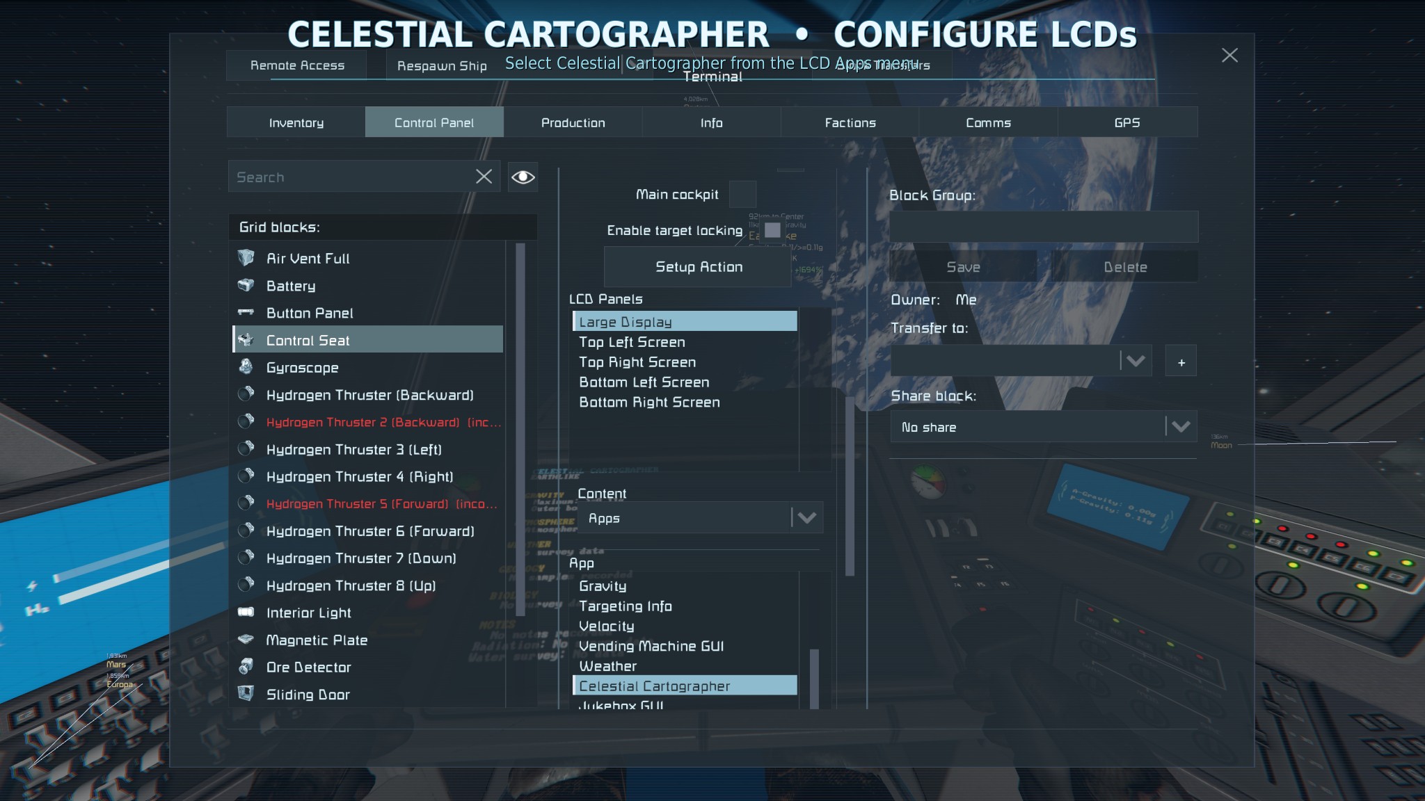
Select Celestial Cartographer from a text surface's normal Script/App list. Put ordinary /cc report commands in the block's Custom Data, such as:
/cc here compact
/cc Earth
/cc Xena geology
/cc Xena notes
Stack commands for larger reports. Wide displays can use two columns; narrow surfaces fall back to one. Multi-screen blocks support separate queries/layouts with [CC] and [CC:n] sections. Toggle the large title with /cc title on or /cc title off.
Shell performance controls
Disable unwanted shells to reduce drawing work:
/cc shells water off
/cc shells atmosphere off
/cc shells all off
Replace off with on to restore them. These controls do not change the survey sampling rates.
For context, a 105-second near-ground Alien test on a system using an RTX 3090 averaged 1.50 ms per Cartographer main update, including an average 0.84 ms for the two visible shells combined. The shell measurement includes CPU preparation and draw submission; GPU time and individual shell costs were not measured. Results vary with the scene and hardware. This performance capture preceded the final water-discovery correction.
Configuration and performance reports
Use /cc config for live settings and /cc debug on|off for development diagnostics.
Performance collection is off by default. To capture a slowdown:
/cc debug off
/cc perf onHighlights
From source dataFootprint
Rated a light load on a server.
Last update
Its author last shipped an update 36d ago.
CelestialCartographer on Nxeon
From our catalogue- One-click install
- Not available. One-click install isn't available for this game's mods yet. Download it and upload it to your server in Files.
- Server load
- light
- Smallest plan we suggest
- Space Engineers — 8 GB (8 GB RAM). This follows our own load rating above, not a benchmark.
- Latest build
- 2026-09-29, released 2026-09-29
Game versions by loader
| Loader | Game versions | Newest |
|---|---|---|
| Workshop |
From 1 recorded build of CelestialCartographer.
Dependencies
- Required: Text HUD API
Declared by the newest build that lists any. Required ones are installed with it on one-click installs.
Run CelestialCartographer on a Space Engineers server
Deploy a server above, then upload the file in Files.
What kind of mod it is
From the catalogQuality of life & UI
Small conveniences, tweaks and interface improvements players notice straight away.
Compatibility
- Game
- Space Engineers
Verified at the source
- ✓Steam WorkshopOfficial listing, checked 2026-10-11Open ↗
- ✓AuthorRaguel, as published on Steam Workshop
- ✓LicenseNot published by the sourceFree