




About LiDAR Mapping Script
From Steam WorkshopVersion 6.9.1 released December 20, 2021 Hello, Engineers, and welcome to version 6 of the LiDAR mapping script! This version boasts a fresh new look utilizing the drawing library introduced in SE…
Version 6.9.1 released December 20, 2021
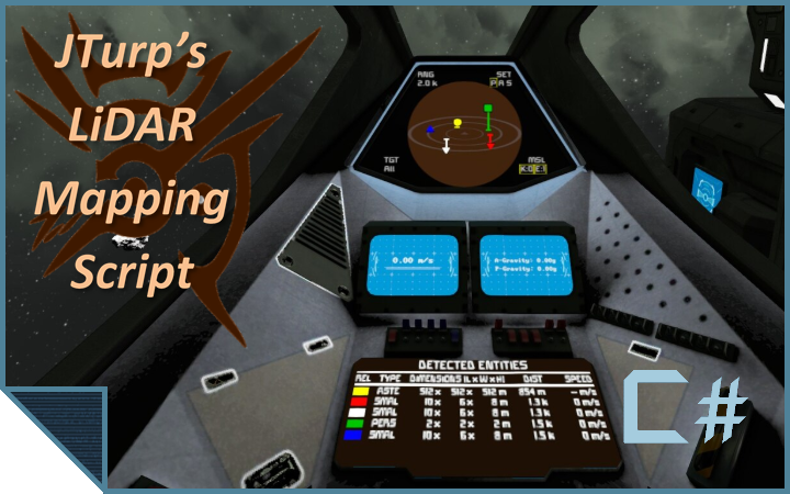
Hello, Engineers, and welcome to version 6 of the LiDAR mapping script! This version boasts a fresh new look utilizing the drawing library introduced in SE v1.190.
Blueprints
Here are a couple of ready-made blueprints to try out :)[list] [*] Camera Version: LiDAR Platform with Cameras [Vanilla] [*] Sensor Version: LiDAR Platform with Sensor [/list]
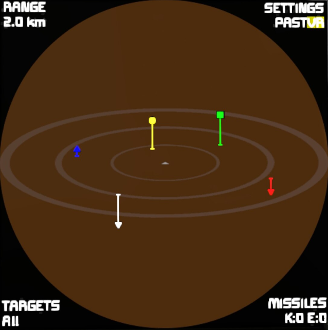
[h1]Current Features[/h1][list] [*] Will use any number of cameras and / or turrets and / or a modded sensor to display near-real-time tracking information on an angled viewing plane[list] [*] If no detection block is found by the script, it will default to "Relay Only" mode. In this mode, only objects that have been found and relayed by another LiDAR system will be displayed[/list] [*] Each system is capable of relaying 'known' objects to other grids in antenna range [*] Rotor-based cameras will track objects in their given sector to ensure you don’t lose sight of the object. [*] The map and information output can be displayed on any LCD, including cockpits and flight seats! [*] Activate Info LCDs (default F key) to auto-download all known grid coordinates to the suit GPS [*] Grids can be selectively added to a 'blacklist' to ensure the script does not fire upon them [*] Detection- and distance-based timer options. You can have the script run any number of timers, either when detecting a new object or when an object crosses a distance threshold (both ways). [*] Offers the ability to override the default turret AI in favor of a much more accurate ballistic algorithm[list] [*] You may set which target types a controlled turret can auto-fire against in the Custom Data of the PB [*] If you have a target selected on the map, all turrets will redirect their fire at it [*] Modded turrets are supported. See the Custom Data of the turret to enter the necessary information [*] Overridden turrets can take advantage of the 'Precision Aiming' capability of the script [*] NOTE: You cannot use the same turret for both target scanning and AI override, you must pick one (you can have both options at the same time, you just need separate turrets for each)[/list] [*] Player-built missiles are supported using connectors, rotors and merge blocks[list] [*] You may select a displayed target as well as which payload type to deploy via PB arguments [*] Once a target has been selected, you may launch a missile at the target via PB arguments [*] The Auto Launch feature takes care of both of the above items for you. Any enemy grid that comes within a configurable range will automatically be fired upon, provided you have the missiles available to do so [*] Missiles will automatically be redirected to other targets (if any) if their intended target is lost for any reason[/list][/list]
A Note For Those Using Cameras
Camera raycasts are limited by the game's recharge rate (2km/s in vanilla) as well as the script (for performance reasons). The easiest method of tracking objects is to install one of the sensor mods available on the WS. CalDaug2020's will detect anything within 10km (adjustable) for large grids, and 5km for small. This mod can be found here
How does this work?
As there is a lot to cover, please refer to the guide for details on setting everything up and how everything works.
The accompanying LiDAR Guided Missile Script can be found here
Feel free to leave a comment or question, and I'll do my best to accommodate requests as much as is feasible. And please rate if you like the script :)
Update Notes
Dec 20[list] [*] Added check for null camera names during camera setup[/list] Feb 3[list] [*] Added a missile icon for player-built missiles. Owned / relayed missiles will be shown as such on the map [*] Adjusted highlights on the map display to better fit over the text[/list] January 28[list] [*] Fixed an issue with turrets firing at selected target even if it's blacklisted [/list] January 27[list] [*] Fixed an issue with missiles not firing for grids that don't have thrusters (rovers) [*] Added a "Deselect" command to clear the target selection[/list] December 22[list] [*] Fixed issue with multi-screen config overwriting other configs in the Custom Data[/list] December 19[list] [*] Fixed issue with script forcing scan range to 3000 every recompile / reload [*] Fixed potential issue with script not saving new settings if recompiled too soon after change[/list] November 17[list] [*] Added Raycast limit options to the Custom Data Config[/list] October 20[list] [*] Fixed crash when firing missiles that share the same projector[/list] October 11[list] [*] Reworked missile manager to fix issue with "Script too complex" error with very large grids [*] Removed the limit on displays so that Single- and Multi-display modes can be used simultaneously[/list] September 16[list] [*] Compatibility update for missile script update[/list] August 28[list] [*] Fixed issue with objects having a relationship of "Friends" shown as "Unowned" or missing[/list] July 2[list] [*] Cameras will now shift their center point by a tenth of the angle step after completing a full scan revolution, allowing them to scan more points[/list] June 13[list] [*] Updated multi-surface config to allow simultaneous use of other scripts [*] Added workaround for sprite issues in MP[/list] June 3[list]
Highlights
From source dataFootprint
Rated a light load on a server.
Last update
Its author last shipped an update 5 yr ago.
LiDAR Mapping Script on Nxeon
From our catalogue- One-click install
- Not available. One-click install isn't available for this game's mods yet. Download it and upload it to your server in Files.
- Server load
- light
- Smallest plan we suggest
- Space Engineers — 8 GB (8 GB RAM). This follows our own load rating above, not a benchmark.
- Latest build
- 2021-12-21, released 2021-12-21
Game versions by loader
| Loader | Game versions | Newest |
|---|---|---|
| Workshop |
From 1 recorded build of LiDAR Mapping Script.
Run LiDAR Mapping Script on a Space Engineers server
Deploy a server above, then upload the file in Files.
What kind of mod it is
From the catalogQuality of life & UI
Small conveniences, tweaks and interface improvements players notice straight away.
Compatibility
- Game
- Space Engineers
Verified at the source
- ✓Steam WorkshopOfficial listing, checked 2026-11-01Open ↗
- ✓AuthorjTurp, as published on Steam Workshop
- ✓LicenseNot published by the sourceFree